
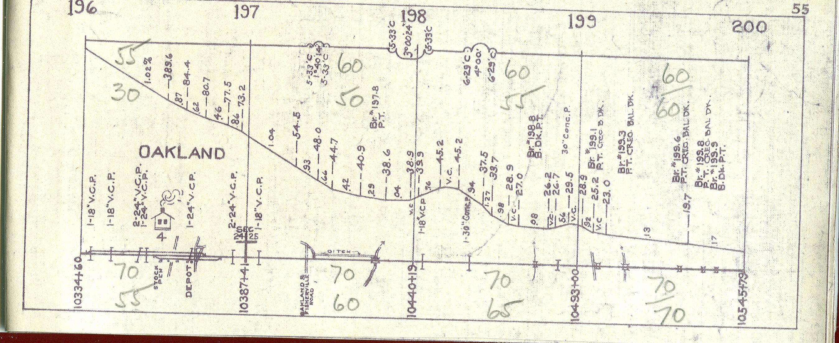
Oakland |
||||||
|
Abandoned NC&STL Railway Oakland Station - Milepost 196.7
"It looks like the remainder of an old scale. Lots of old depots had a scale where the farmers or whoever would drive their wagon onto it to weigh the freight. The scale platforms were usually made out of wood and could be dis-assembled and the scale parts removed and re-used elsewhere. The base of the scale was concrete and too hard to remove so many were just left in place." Anonymous
See track realignment located in west of Oakland.
|
||||||
|
|
||||||
| Eric's
Homepage | Bridges
| Depot List
| Mystery Station
| Photos |
Railroad Museums This page maintained by Eric C. Fleet. |
||||||


NC&StL Preservation Society is in no way affiliated with the NC&StL
Railway or any of it's successors.
As a non-profit entity, NCPS presents these pages to the public purely
for educational and historic interest.
Return
to top |
Home | About
Us | History | Engine
576 | Cities | People
| Model
Railroading
Membership | Merchandise
| Links | Site
Map | Contact Us | Privacy
Policy
If you have information
you would like to contribute,
we would appreciate
hearing from you.
© 2003-2008, Nashville, Chattanooga & St. Louis Railway Preservation Society, inc.