
Memphis Maps |
|||||||||||||
|
Abandoned NC&StL Railway Maps of Memphis Union Station & NC&STL West Yard
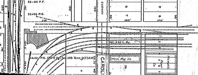
Early 1900's NC&STL Railway line on Frisco Map of Broadway between Memphis Union Station and west of KC Junction. NC&STL Rwy. is the northmost line of seven tracks. The Historic Memphis Union Station Map (1912) 1912
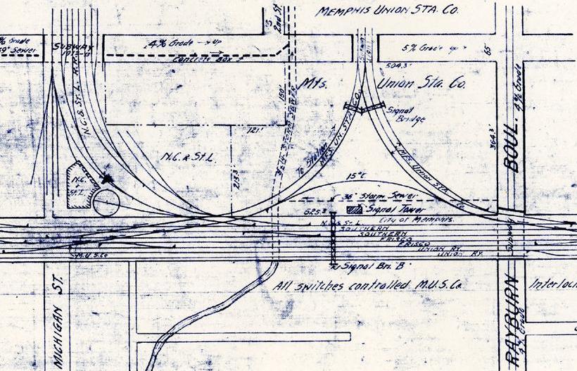
Memphis Union Station Co. Plan of Terminal Facilities
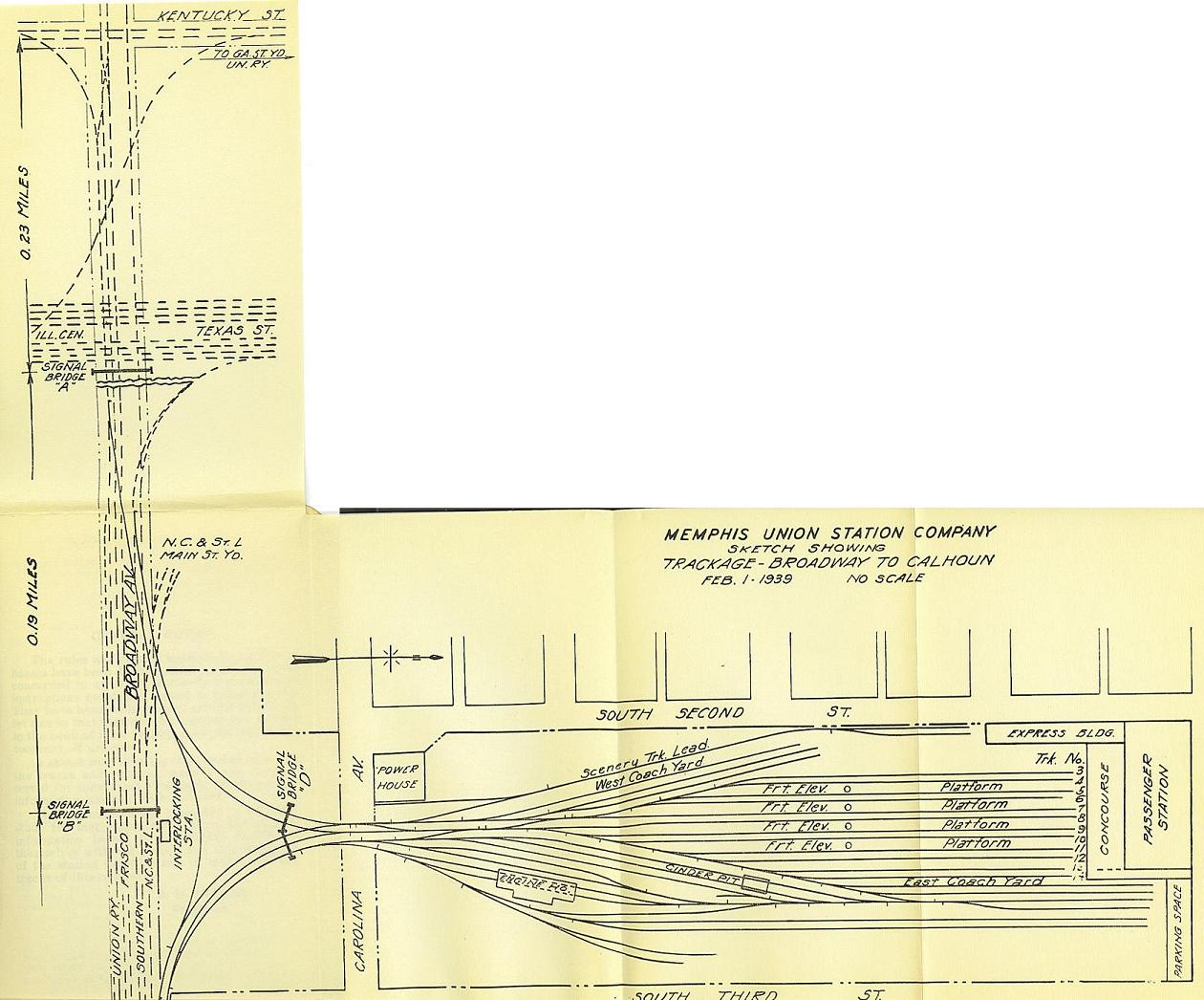
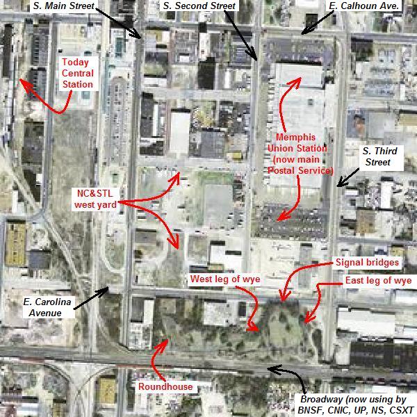
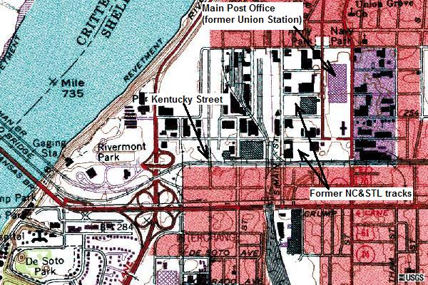
Trackage Map of formerly Memphis Union Station & NC&STL West Yard is now available. I traced it from the old trackage maps in the 1940's on the urban area aerial photo is from the 2004 USGS flyover. It is greater than 11-inch long by 17-inch length paper prepared by myself which the .PDF byte size is over 2.5M. Send me email asking for a copy of the map.
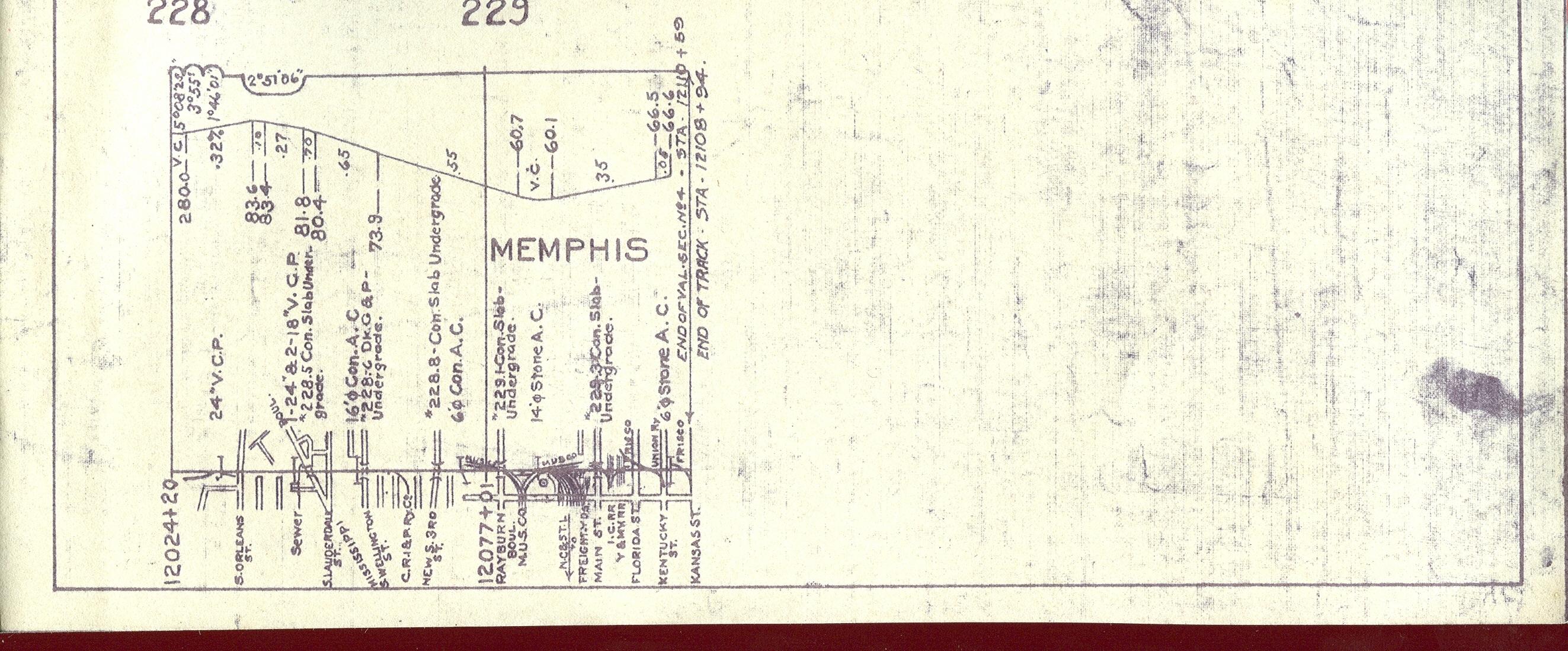
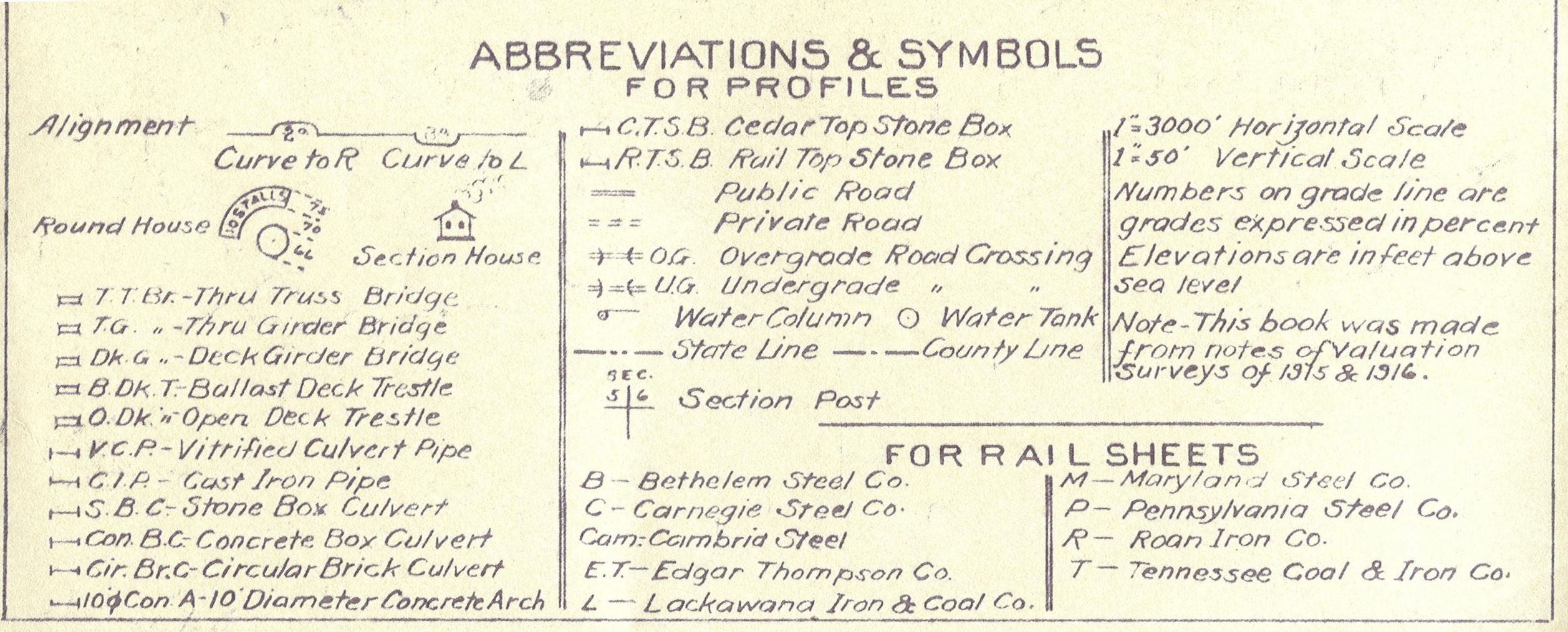
Frisco & Illinois Central crossing profile & track diagram between Bridge Junction in West Memphis, Arkansas and CRI&P Railway Yard in east of Memphis Union Station including NC&STL line (circa 1920's)
|
|||||||||||||
|
|
|||||||||||||
| Eric's
Homepage | Bridges
| Depot List
| Mystery Station
| Photos |
Railroad Museums This page maintained by Eric C. Fleet. |
|||||||||||||


NC&StL Preservation Society is in no way affiliated with the NC&StL
Railway or any of it's successors.
As a non-profit entity, NCPS presents these pages to the public purely
for educational and historic interest.
Return
to top |
Home | About
Us | History | Engine
576 | Cities | People
| Model
Railroading
Membership | Merchandise
| Links | Site
Map | Contact Us | Privacy
Policy
If you have information
you would like to contribute,
we would appreciate
hearing from you.
© 2003-2008, Nashville, Chattanooga & St. Louis Railway Preservation Society, inc.